Coordinate Transformations in Portugal
Datum transformation grids in NTV2 format
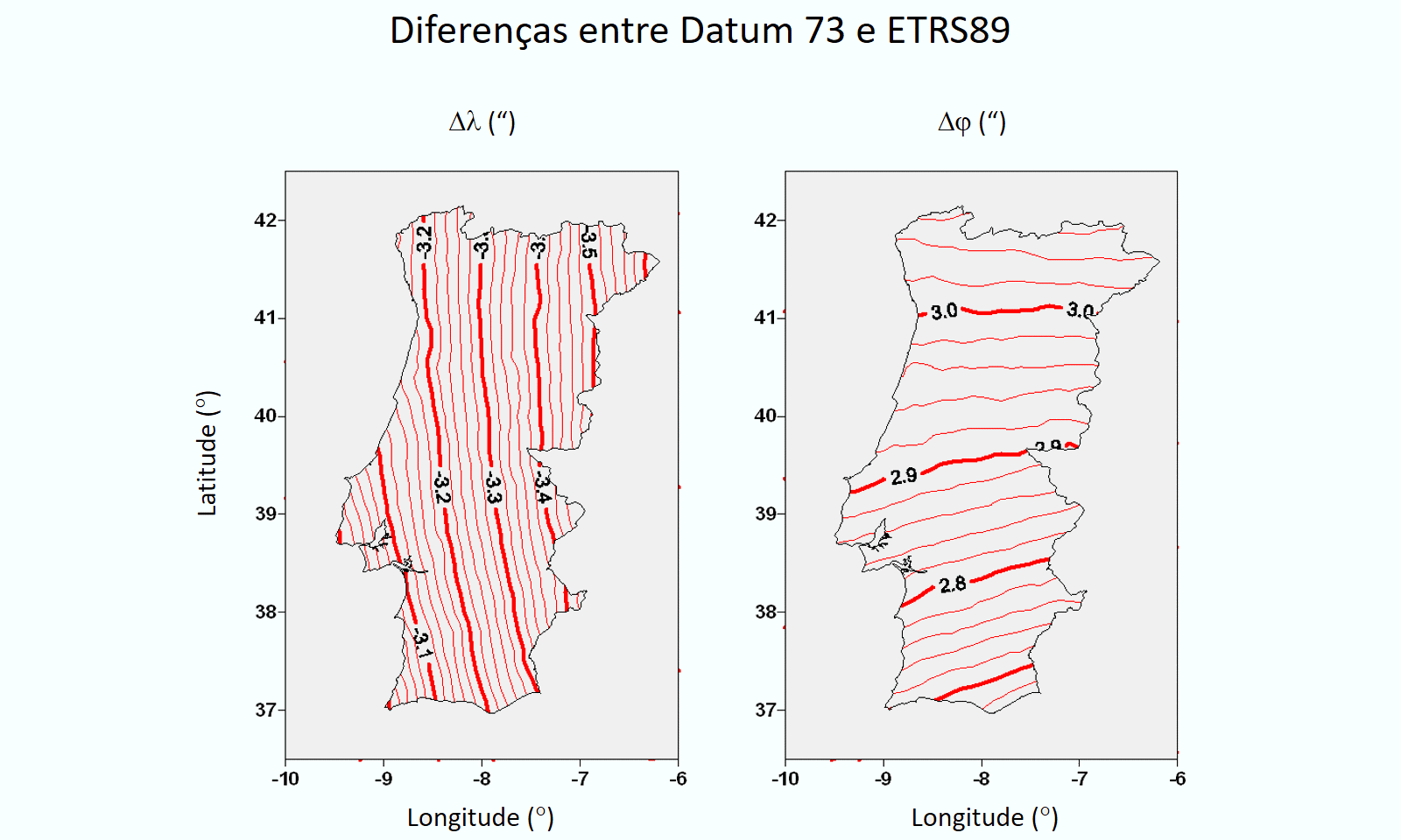
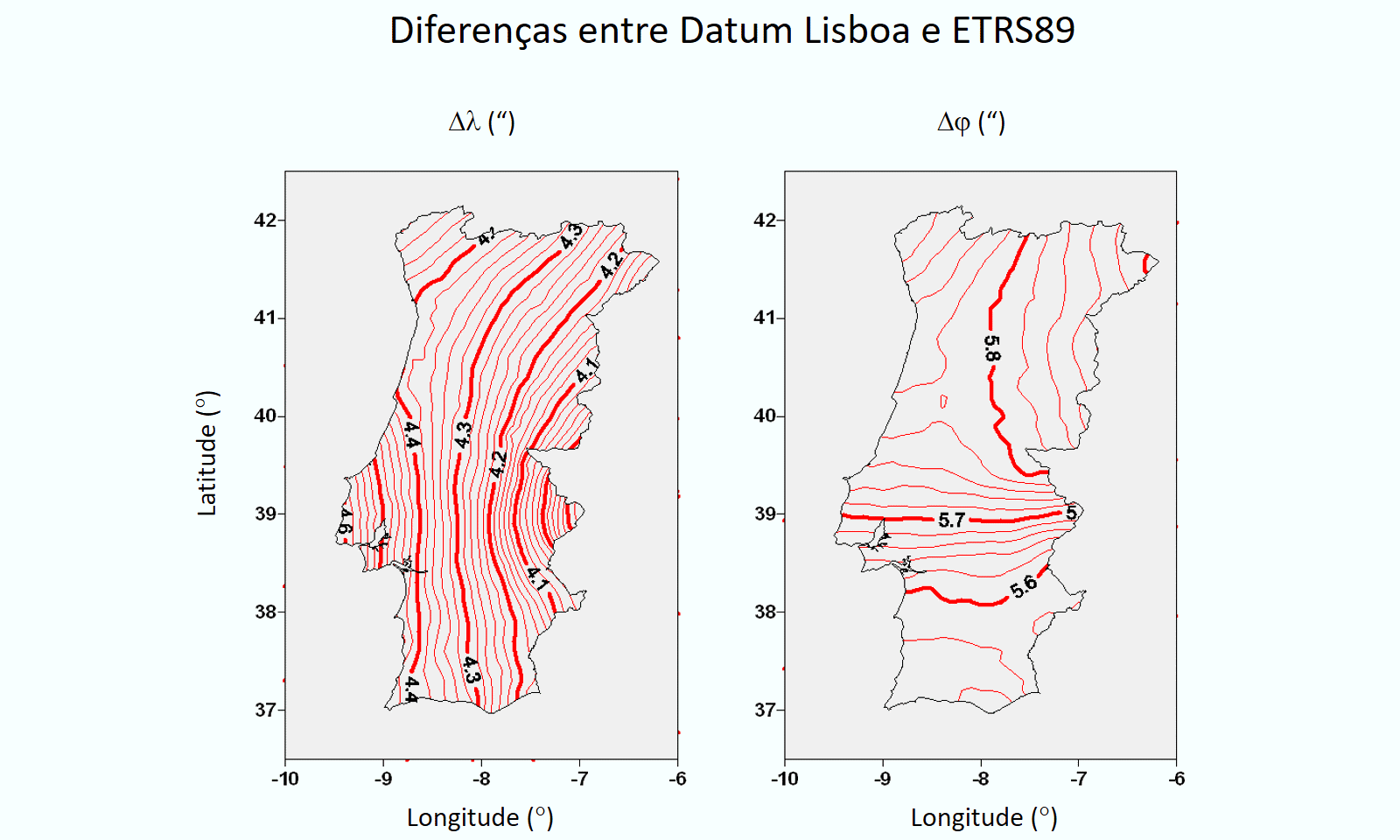
The datum transformations, between a local datum and a global datum, are often performed by the Bursa-Wolf transformation, based on translation, rotation and scale over geocentric cartesian coordinates. These transformations are approximate, often involving errors of a few meters, not modeling deformations of the geodetic network, which defines the local system. The following figures show the differences in geodetic coordinates in seconds of datum 73 to ETRS89 and of datum Lisbon to ETRS89. The deformations are greater in the case of the Lisbon datum
The Portuguese Geodetic Institute (Direção Geral do Território, DGT in Portuguese) has observed about 1600 geodetic vertices in Portugal Continental. With this information and the geographic coordinates in the old systems it was possible to determine grids of coordinate differences to ETRS89, of datum 73, datum Lisbon (Hayford ellipsoid), European Datum 1950 and datum Lisbon (Bessel ellipsoid). A grid with a spacing of 0.1 degrees was used, which is sufficient to model the differences and does not excessively bias the points that have the largest errors.
More information about the generation of grids can be found in the following article of the CNCG2009 The grid files can be downloaded at: NTV2 grids for Portugal (José Alberto Gonçalves).
The ZIP file contains the grids of the four old systems and a grid of the national geoid undulation (GeodPT08). It also contains a projection configuration file for use with the PROJ program. The DGT grids, with a spacing of 0.02 degrees, can also be used for datum 73 and datum Lisbon.
Coordinate transformation with the PROJ program
TBD
Transforming raster and vector files with GDAL software
TBD
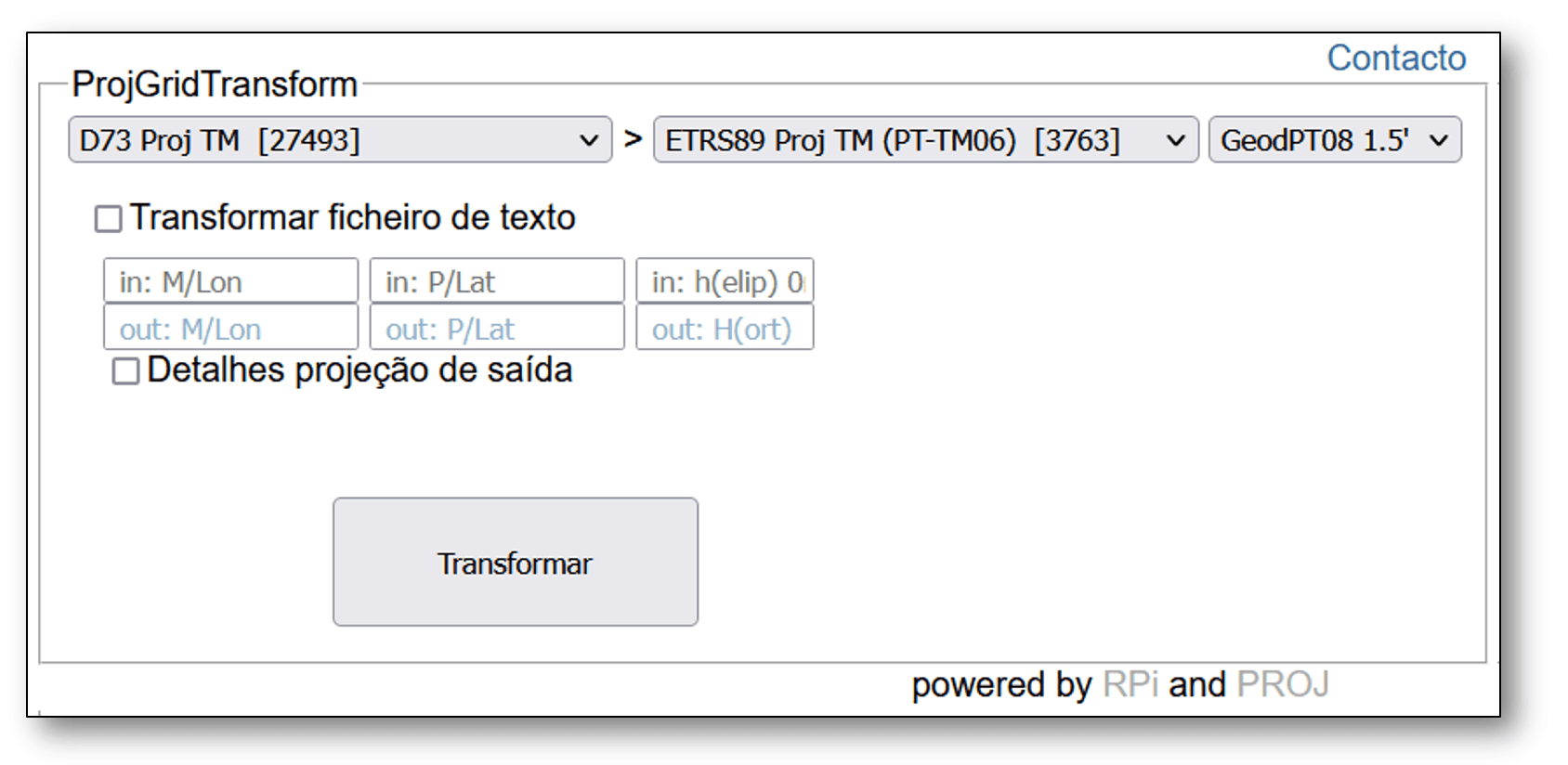
Web interface for coordinate transformations
Click the image below to access an external interface, a coordinate transformation service developed by André Pinhal, a PhD student at FCUP, which uses grids to make several coordinate transformations. The transformation can be applied to individual points in the interface, or to text files. It also includes altitude transformation with the national geoid undulation model (GeodPT08). The interface also allows you to calculate values of deformation of the projections.